

Drone Archaeology: Exploring Ancient Sites from…
In This Article
- Drone Archaeology uses cutting-edge UAVs to transform excavation and analysis techniques.
- Orthomosaics and LiDAR mapping reveal ancient sites hidden under terrain or vegetation.
- 3D reconstruction via photogrammetry enhances both research and preservation.
- Drones reduce environmental impact and improve safety in archaeological fieldwork.
- Ethical usage and community engagement are vital to sustainable drone-driven discovery.
The Rise of Drone Archaeology
How UAVs Are Changing Excavations
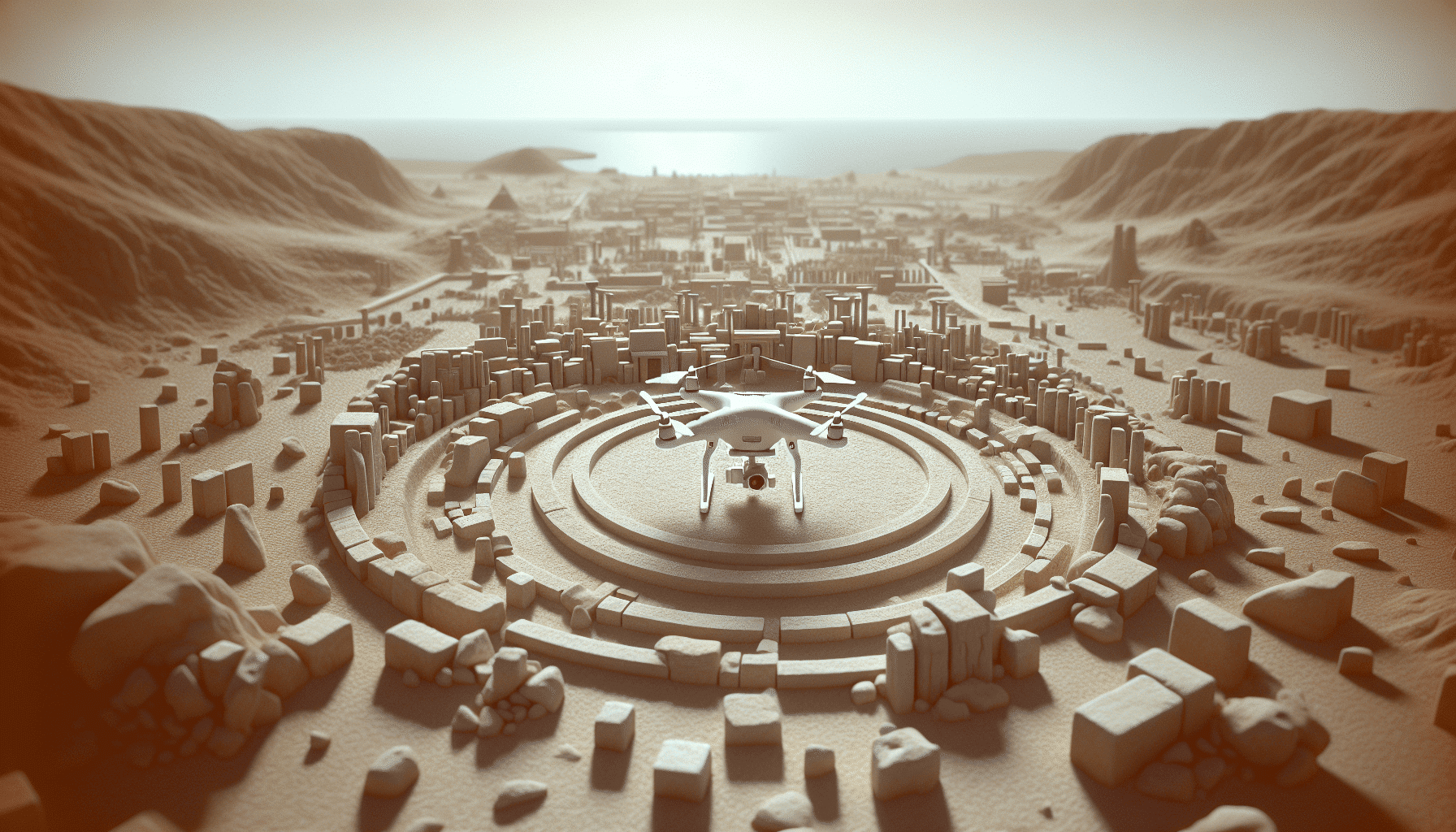
Drone Archaeology, also known as aerial archaeological surveying via drones or UAVs (Unmanned Aerial Vehicles), represents a seismic shift in the way cultural and historical remains are discovered and analysed. Traditionally, archaeologists relied on ground-based techniques such as gridding and excavation, which, while effective, limited the scope and speed of discovery. However, with drones now in the picture, the field has expanded into a more efficient, data-rich domain.
Uncovering the Past: The Role of Drones in Archaeological Discoveries
UAVs are transforming excavations by offering a bird’s-eye view of vast landscapes, enabling researchers to spot subtle differences in topography, soil colouration, and vegetation patterns — all of which can hint at underlying archaeological features. These visual clues, rarely visible from the ground, become evident when observed from above, especially using imagery captured under varied lighting conditions and angles.
Moreover, Drone Archaeology allows for non-invasive assessments of sites before physical tools are ever used. This is particularly valuable in culturally sensitive or protected areas where excavation may be restricted. In this way, drones serve as eyes in the sky, dramatically increasing the speed and scope of archaeological discovery. Learn more about Drones in Archaeology
Mapping Ancient Worlds from the Sky
Orthomosaic Maps and High-Resolution Imaging
One of the most significant contributions to Drone Archaeology is the ability to create accurate orthomosaic maps — high-resolution, georeferenced images stitched together from hundreds or thousands of drone-captured photos. These maps provide a comprehensive overview of archaeological landscapes, allowing researchers to identify structures, roadways, and agricultural patterns that may have been invisible on the ground.
Choosing the Right Equipment: The Best Drones for Archaeology
These visual archives are not only detailed, but also invaluable for temporal analysis. Repeated flights over the same site enable archaeologists to monitor changes over seasons or years, capturing environmental shifts or even illicit site disturbances. This functionality makes high-resolution imaging particularly useful in remote areas, where regular monitoring had been virtually impossible before drone integration.
Orthomosaic imagery also aids interdisciplinary collaboration by allowing archaeologists to share detailed site data with geologists, architects, and historians worldwide. These images are often overlaid with GIS (Geographic Information System) data, unlocking powerful layers of analysis and interpretation. The Rise of Drone Technology in Archaeology
“From the sky, we can read the ancient script etched into the Earth’s surface — trenches, pathways, and settlements re-emerge with every flight.”
LiDAR Technology in Archaeology
LiDAR (Light Detection and Ranging) represents another frontier in Drone Archaeology — one that is particularly useful in vegetated or forested regions. Mounted on drones, LiDAR sensors emit laser pulses that penetrate foliage, recording the distance between the drone and the ground with pinpoint accuracy. The resulting data produces detailed topographic maps that can “see through” vegetation, revealing structures hidden below tree cover.
Preserving Heritage: Safety of Drones in Ancient Site Exploration
In regions like Central America and Southeast Asia, LiDAR-equipped drones have exposed entire ancient cities that had been completely concealed by jungles. From Maya pyramids to Angkor temples, these rediscovered sites underscore the extraordinary power of LiDAR in modern excavations. Notably, these findings have reshaped historical narratives, suggesting far more extensive urbanisation and infrastructure than previously imagined.
Additionally, LiDAR-generated models often require minimal post-processing compared to traditional survey techniques, making them time-effective and highly precise. As accessibility to LiDAR sensors improves, it’s likely this technology will become a standard tool in the Drone Archaeology toolkit.
Photogrammetry and 3D Modeling Techniques
Photogrammetry has long been a valued method in archaeology, but its integration with drone technology has brought about a renaissance in 3D site modelling. By capturing hundreds of overlapping images from various angles, drones facilitate photogrammetric reconstruction of artefacts, landscapes, and even entire structures in digital three-dimensional space.
Mapping the Unknown: Drone Technology for Ruins
These highly detailed 3D models allow researchers to conduct further analysis without compromising the integrity of the site. Scholars can ‘visit’ ancient ruins remotely, explore walls, staircases, and carvings virtually, even calculating measurements with sub-centimetre precision. This not only aids interpretation but also bolsters conservation, enabling preservation of high-fidelity digital records.
The application of such models has also expanded into education and public outreach. Schools, universities, and museums increasingly adopt VR-compatible 3D reconstructions to immerse audiences in virtual archaeological experiences. This democratisation of knowledge underscores the societal value of Drone Archaeology.
Case Studies: Lost Civilisations Rediscovered
Drone Archaeology has already contributed to several landmark discoveries. For example, in the Peruvian Andes, UAVs identified the outlines of pre-Incan settlements spanning thousands of square kilometres. These sites showed signs of advanced water management and urban planning.
The Advantages of Drone Delivery: Benefits Beyond Archaeology
In another striking case, drone flights over the Jordanian desert revealed “kite traps” — stone enclosures used for hunting — that had been missed by decades of ground surveys. These planes-like structures led to new insights into Neolithic hunting practices.
Perhaps most dramatically, drones equipped with LiDAR uncovered a lost network of Maya roads and structures beneath the Guatemalan jungle canopy. This discovery not only redrew maps, but completely reshaped concepts of Mesoamerican urbanisation. Each of these examples proves how indispensable Drone Archaeology has become in rewriting human history.
Environmental Benefits of Drone Use
Unlike large-scale excavation or manned aerial surveys, drones offer a minimal-impact approach to exploration. Their small size, electric power, and GPS-guided autonomy reduce environmental footprint considerably. This is a crucial advantage when operating in ecologically fragile or UNESCO-protected areas.
Drone Archaeology also promotes sustainability by reducing the need for extensive travel. Local drone operators can survey sites and upload data to cloud platforms, thereby lessening the carbon impact of global travel. Moreover, because drones enable non-invasive diagnostics, they help preserve site integrity, reducing unintended damage to cultural layers.
In sum, drones represent a greener tool for archaeological discovery — one that aligns both with heritage conservation and environmental responsibility. Read a related article
Improving Safety and Efficiency in the Field
Fieldwork often presents physical risks to archaeologists, especially in unstable or undeveloped terrains. Drones help mitigate these risks by surveying dangerous or inaccessible areas before any human engagement. Landslides, flooding, or animal encounters can be anticipated through aerial inspection, enhancing site-worker wellbeing.
Furthermore, GPS-guided flight paths and automated data capture drastically cut the time and labour required for initial site assessments. What once took weeks of on-foot grid mapping can now be accomplished in a few hours with drone support. This efficiency translates into cost savings and more productive campaigns.
Additionally, drones enable rapid response to newly discovered or threatened sites. When looting or construction encroaches on heritage areas, drones can be deployed instantly to document and intervene. In this way, Drone Archaeology serves both science and cultural protection.
Tools and Sensors Used in Drone Surveys
Drones used in archaeology are typically equipped with a range of sensors tailored to specific tasks. RGB cameras, capable of 20MP or higher, are the standard for visual surveys. Multispectral sensors, on the other hand, detect light across various wavelengths, revealing changes in plant health that may correspond with subsurface features.
Thermal imaging is another valuable tool. At dawn or dusk, temperature variances on the ground can indicate buried structures which retain or emit heat differently than surrounding soil. Combining these thermal maps with visible light imagery helps validate hypotheses before excavation begins.
The drones themselves vary from compact quadcopters ideal for confined spaces to fixed-wing models suited to large-scale landscape surveys. The integration of RTK (Real-Time Kinematic) GPS systems ensures positional accuracy down to centimetres. These components together make Drone Archaeology an adaptable, powerful method.
Ethical Considerations and Site Preservation
While the benefits of Drone Archaeology are undeniable, ethical guidelines must steer its application. Chief among these is consent — the use of UAVs around indigenous or sacred sites demands informed approval from local communities. Cultural sensitivity is paramount, and collaborative partnerships are preferred over extractive research models.
Data security is another concern. High-resolution imagery and 3D models carry detailed information that, if improperly shared or commercialised, could endanger fragile sites or encourage looting. Thus, ethical Drone Archaeology includes responsible data handling and long-term digital stewardship strategies.
Finally, drone usage must comply with both national aviation regulations and heritage protection laws. Archaeologists must work alongside legal and aviation authorities to ensure their research adheres to these frameworks.
Future Frontiers: AI and Autonomous Drone Research
The future of Drone Archaeology is increasingly intertwined with artificial intelligence. AI can analyse terabytes of imaging data far more quickly than humans, spotting anomalies or patterns that could indicate archaeological significance. This accelerates the research cycle and leads to the discovery of sites that might otherwise have been overlooked.
Autonomous drones are also becoming viable. These craft can self-navigate complex terrain, update flight paths in real-time, and adjust sensor parameters dynamically. The fusion of AI-driven analysis and autonomous mobility suggests a research paradigm where machines manage the aerial survey, freeing human experts for interpretation and field verification.
As these technologies evolve, Drone Archaeology will continue to push the boundaries of what we consider discoverable, unveiling secrets from every corner of the Earth.
Community Involvement and Citizen Science
Drone Archaeology isn’t limited to institutional research; it has significant potential for citizen engagement. Efforts like open-air museums, public mapping projects, and volunteer training programmes are inviting communities to participate in archaeological discovery.
Through pilot training and open-source software, local residents can conduct legitimate surveys of regional heritage sites, archiving them for future generations. This empowerment fosters stewardship and reduces dependence on international funding. Moreover, amateur contributions to publicly accessible datasets — such as drone imagery uploads to global heritage repositories — are becoming an essential source of crowd-sourced data.
In this inclusive model, Drone Archaeology becomes not just a tool for academic insight but also a vehicle for cultural identity and education.
Conclusion: The Ever-Expanding Horizon of Drone Archaeology
[CONCLUSION_CONTENT]
Great guide on the-impact-of-drones-on-archaeological-discoveries – Community Feedback
How are drones changing archaeological research?
Drones provide high-resolution aerial imagery that helps archaeologists map sites accurately, monitor progress, and uncover hidden structures—quickly and safely.
What technologies do drones use in archaeology?
Common technologies include RGB cameras, multispectral sensors, and LiDAR, enabling detailed mapping and analysis of archaeological sites.
Are drones making archaeology safer?
Yes. Drones reduce the need for manual site surveys and allow archaeologists to study hazardous or hard-to-reach areas without personal risk.
What are the environmental benefits of drones in archaeology?
Drones minimise site disturbance and aid in conservation by providing non-invasive investigations and ongoing site monitoring.