Aerial Data Innovation Across Industries and Se…
In This Article
- Aerial data innovation enriches real-time decision-making in agriculture, construction, and environmental monitoring.
- AI and machine learning vastly improve the interpretation of drone-collected data for faster, smarter outcomes.
- Smart compliance and data governance are vital as drone usage expands across sectors and borders.
- The synergy between aerial data and IoT unlocks fully connected intelligent operational ecosystems.
- Emerging trends like drone swarms and onboard AI signal an exciting future for aerial technologies.
Understanding Aerial Data and Industry Innovation
The Rise of Drone-Driven Data Collection
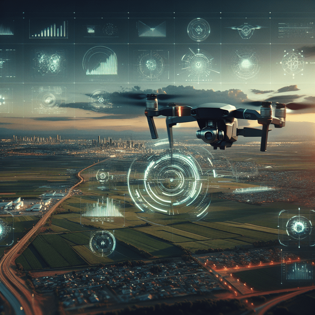
In recent years, aerial data innovation has evolved from a niche capability into a strategic driver across a multitude of industries. Whether captured by drones, aeroplanes, or satellites, aerial data provides high-resolution views of terrains, construction sites, crop fields, and even conflict zones. The combination of real-time imagery, LiDAR scanning, and geospatial analytics allows organisations to make informed decisions faster and with greater accuracy.
The meteoric rise of unmanned aerial vehicles (UAVs), commonly known as drones, has especially accelerated this trend. No longer restricted to military use or hobbyist applications, drones are now equipped with powerful sensors and imaging technologies that enable them to collect volumes of data previously unimaginable. Their agility, affordability, and real-time capabilities make them indispensable tools for sectors ranging from agriculture to disaster response.
As the use of drones increases, so too does the volume of data they produce. This burgeoning field of aerial data innovation relies on robust analytics platforms to distil actionable insights from raw visual and infrared data streams. Companies are now investing heavily in AI and machine learning algorithms that can process, interpret, and visualise data in meaningful ways. As a result, industries are experiencing a paradigm shift in how they approach spatial awareness, prediction, and operational deployment.

Precision Agriculture and Smart Farming
Optimizing Crop Yields Through Aerial Insights
In agriculture, aerial data innovation is revolutionising how farmers manage resources, monitor crop performance, and improve yield outcomes. Through drones equipped with multispectral sensors, farmers can survey vast acres of farmland in a fraction of the time required by traditional methods. These surveys can reveal critical details such as chlorophyll levels, moisture content, and early signs of plant diseases, all without physically disturbing the crops.
Using aerial imagery and data analytics platforms, modern farms can generate prescription maps to guide precision seeding, irrigation, and fertilisation. This targeted approach significantly reduces waste and enhances profitability. Rather than applying chemicals uniformly across a field, farmers utilise data to apply resources only where they’re needed—resulting in measurable environmental and financial gains.
Additionally, aerial data supports compliance with evolving agricultural regulations. Many governments mandate the proper tracking and documentation of pesticide use, soil conditions, and water consumption. Aerial analytics provide timestamped, geo-specific evidence of such practices, meeting regulatory standards while also offering farmers a competitive technological edge.
“Drones and aerial imaging have given us eagle-eyed insight into every aspect of our crops, transforming efficiency from soil to silo.”
Construction Monitoring and Infrastructure Planning
On construction sites, aerial data innovation enables continuous, real-time oversight of ongoing projects. Planners can now acquire orthomosaic maps and 3D models of construction zones that mirror architectural designs and blueprints. By identifying disparities between planned and actual progress, teams can quickly adjust operations, saving time and preventing costly errors.
In addition, UAVs help ensure worker safety by providing access to high-risk areas without placing humans in danger. Monitoring large-scale construction zones from the air also aids in tracking materials, workflow bottlenecks, and equipment usage. Most importantly, progress reports generated from drone imagery help stakeholders stay updated remotely, enhancing transparency and accountability across the supply chain.
When layered with AI, modern aerial platforms can detect deviations in engineering tolerances, measure volumetric changes, and validate compliance with construction codes. This not only assures quality but also accelerates the handover timeline to clients and investors.
Geospatial Data for Urban Planning
Aerial data plays a key role in urban development by offering planners unparalleled insights into evolving cityscapes. City councils and planning departments leverage this data to assess land-use patterns, traffic congestion, and spatial accessibility. Aerial surveys help experts simulate future infrastructure projects, perform environmental impact assessments, and design smarter public transport solutions.
What sets aerial data innovation apart in urban planning is its scalability. Planners can study a single roundabout’s effect on traffic flow or the placement of hundreds of hectares of smart green space—all from detailed aerial analytics. This top-down perspective is essential for managing population growth, minimising sprawl, and promoting sustainability in modern urban hubs.
Moreover, integrating aerial visuals with GIS systems enables dynamic maps that reflect real-time changes in the urban environment. These maps support predictive modelling for everything from parking availability to emergency response routing—raising both civic ambitions and citizen satisfaction. For more applications, visit Learn more about Aerial Data & Drone Industry Innovation.
Environmental Monitoring and Compliance
The power of aerial data innovation extends to environmental protection initiatives worldwide. Conservation groups utilise drones to map deforestation trends, monitor wildlife movements, and detect illegal activities like poaching and mining. Because drones can reach areas inaccessible by foot or vehicle, they provide a timely edge in ecological preservation.
Aerial surveillance proves critical for monitoring bodies of water for pollutants, tracking erosion, and verifying compliance with environmental legislation. Industries operating under strict ecological regulations—such as energy and mining companies—can deploy drones to conduct audits and inspections, drastically reducing both time and human risk exposure.
Equipped with thermal sensors and hyperspectral cameras, some drones are capable of detecting gas emissions and temperature differentials, translating invisible data into critical environmental intelligence. These capabilities bolster transparency and support green initiatives at corporate and governmental levels. Access additional guidance through Explore the rise of aerial data in agriculture decision-making.
Security and Defense Applications using Aerial Data
Aerial data innovation has deep roots in the defence sector, where it has long served intelligence gathering, perimeter surveillance, and battlefield analysis. Modern UAVs are more agile and less detectable than traditional surveillance aircraft, making them ideal for reconnaissance and mission planning.
In addition to situational awareness, drones assist in search and rescue operations by covering vast terrain quickly and zeroing in on heat signatures. Border agencies deploy UAVs to monitor illegal crossings and track suspicious vehicle movement with pinpoint accuracy. Live-stream capabilities make aerial vehicles key assets in emergency and crisis zones as well.
Private security services are also adopting drones to patrol commercial estates, monitor crowds, and pre-empt outbreaks of violence. With AI integration, aerial data from these missions can be analysed in real-time, flagging anomalies that demand human intervention. As threats become more complex, aerial surveillance technologies are evolving to meet the challenge.
Role of AI in Processing Drone Visuals
The value of aerial data innovation hinges not just on data collection but on interpretation—and that’s where AI shines. Artificial Intelligence transforms raw aerial footage into structured, actionable intelligence. Automated routines can classify terrain, detect anomalies, and predict future trends based on historical comparisons.
In agriculture, AI can identify individual plant health anomalies across millions of data points. In construction, machine learning algorithms track vehicles and materials with precision. In city planning, pattern recognition tools estimate changes in population density and pedestrian frequency. These advanced analytics free humans from the enormity of manual interpretation and enable timelier, smarter decisions.
AI also plays a pivotal role in automating the flight path and data collection routines of UAVs, allowing consistent, repeatable missions. This reliability is crucial in regimented monitoring scenarios such as pipeline inspections and bridge assessments. For deeper analysis, see our spotlight at Read a related article.
Data Management and Regulatory Compliance for Drones
One of the growing challenges of aerial data innovation is data management. High-resolution footage and sensor data can quickly become overwhelming without robust storage and indexing systems. Enterprises must integrate scalable cloud solutions that offer fast access and reliable security protocols.
Regulatory compliance is also top-of-mind. Different countries and jurisdictions impose unique airspace, privacy, and data governance policies. Failure to comply can result in legal action or financial penalties. As a result, drone operators must stay updated on aviation laws, data storage legislation, and industry-specific usage restrictions.
Fortunately, a wave of new platforms aims to centralise drone data governance, automate logging, and produce compliance documentation. These tools streamline workflows while ensuring each aerial mission is both legal and ethical. As demand for transparency grows, so too does the need for trustworthy data protocols.
Drone Technology and the Internet of Things
The intersection of aerial data and the Internet of Things (IoT) is creating interconnected ecosystems where drones communicate with ground-based sensors and edge devices. From agricultural IoT farms to smart industrial sites, drones now feed data directly into live networks that monitor resource use and equipment efficiency in real time.
This integration reduces response times and facilitates predictive maintenance. For example, a drone inspecting a power line may detect corrosion and instantly upload data to a networked grid system. That system could then alert maintenance crews or automatically schedule repairs. The result is a seamless, responsive framework for asset optimisation.
The aerial component of IoT infrastructure also plays a vital role in disaster readiness. Emergency services can deploy sensors and drones that communicate across rugged landscapes, providing rescue teams with live updates and hazard modelling. Connected aerial systems will continue to redefine how humans engage with machines and their environment.
Future Trends in Aerial Mapping and Automation
As aerial data innovation matures, new technologies are on the horizon. Swarm drone behaviour, where multiple UAVs collaborate on missions autonomously, is already in development. Such systems promise to revolutionise search and rescue, agricultural sweeping, and area mapping with near-instantaneous results.
Spectral imaging sensors are becoming more specialised, allowing for ultra-fine categorisation of minerals, biological agents, or man-made materials across large regions. Additionally, developments in satellite-aided drone guidance promise improved navigation in non-GPS environments, expanding aerial capabilities even deeper into dense forests and remote locations.
The future may also see greater autonomy in data processing. Onboard AI chips could allow drones to analyse footage mid-air, returning not raw data but already distilled insights. Combined with ever-evolving regulations and ethical frameworks, aerial data will increasingly underpin smart infrastructure and climate strategy execution.
Conclusion: Unlocking Efficiency with Aerial Intelligence
Aerial data innovation is no longer a future concept—it is shaping the present in remarkable ways. Across agriculture, security, urban planning, and more, it is redefining how professionals gather insight, respond to change, and drive progress. With the merging of drones, AI, IoT, and cloud platforms, the next era of operational intelligence has already begun. Organisations that strategically implement aerial data will uncover not just efficiency, but transformative growth and sustainability potential.
Great guide on how-aerial-data-is-driving-innovation-across-various-industries – Community Feedback
How do drones impact the acquisition of geospatial data?
Drones speed up data collection over large areas, offer high-resolution imagery for precise mapping, and lower the overall costs of GIS projects.
How does AI enhance the processing and analysis of drone-collected data?
AI algorithms enable detection, recognition, and classification of objects in drone imagery—improving infrastructure assessment, environmental monitoring, and disaster management.
How are drones used in aerial mapping?
They automate flight paths to capture high-quality images, which are then processed into actionable maps and models for various industries.
What types of valuable information can drones collect?
Drones collect imagery, topographic data, 3D models, heat maps, and environmental statistics crucial for decision-making in multiple sectors.